Sequoia Wild Heritage Project

Black Mountain
Slate Mountain
Proposed Wilderness
See also:
- Black Mountain/Slate Mountain Photo Album
- Close-up location map and more detailed description with photos.
Size: The Black Mountain roadless area is approximately 15,041 acres according to Forest service RARE II acres, while the Slate Mountain roadless area is approximately 5,373 acres acres in size for a total of 20,414 acres.
Land management agency: Sequoia National Forest and Giant Sequoia National Monument
RARE II names: Black Mountain Roadless Area and the Slate Mountain Roadless Area.

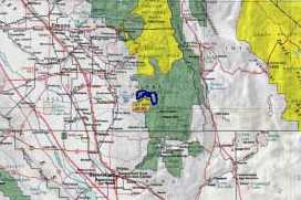
Location: Both of these areas are located within Tulare County and the Sequoia National Monument and National Forest. The Black Mountain Roadless Area lies just east of Porterville, sandwiched between Highway 190 on the north and the Tule River Indian Reservation on the south. The Slate Mountain Roadless Area straddles the summit of the Western Divide about 40 airline miles east of Porterville California, at the higher elevations to the east of the Black Mountain Area. The two areas are separated by a gravel forest road.
This potential wilderness area consists of two different roadless areas, the Black Mountain area and the Slate Mountain area. A narrow gravel forest road separates the two areas, providing hiking access to both areas from the same roadheads. Both areas would provide outstanding opportunities for recreation and protection of valuable natural features. Deer, countless bird species, and numerous species of mammals, including Pacific fisher and spotted owl, are found in the area during the summer. Many of the streams support healthy populations of trout providing excellent recreation opportunities for fishermen.
Most of the lower elevations of the Black Mountain portion are covered by thick high chaparral, a habitat which is unfortunately rarely represented in the National Wilderness System. Between the elevations of 5,000 and 6,000 feet, conifer forest replaces the nearly impenetrable chaparral. It is here that the Giant Sequoia trees lie scattered along the north facing slopes of the forest. The Belknap, McIntyre, Wheel Meadow, Red Hill, and the Black Mountain Groves lie entirely or partially within the area. The Black Mountain Grove is one of the finest groves throughout the range of the Big Trees.

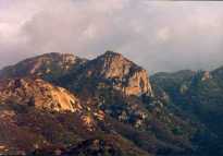
The rugged slopes of Slate Mountain dominate the view into the potential wilderness from most directions. Elevations range from about 5,000 feet to 9,302 feet at the summit of Slate Mountain. The entire area is covered with conifer forests. Large open wet meadows are interspersed throughout along the watercourses. The open sunny meadows and many open but drier areas are covered with wildflowers until late in the summer.
Click here for a larger location map and more detailed description.
For questions about this website or to volunteer to help out, please contact us at: info@sequoianet.org
